

Complete Streets policies are critical to our communities' transportation networks, health and safety, environment, and economies. Yet, transforming roadways into Complete Streets can range from simple to complex. Here are eight common Complete Streets challenges and how your community can overcome them.
According to the National Complete Streets Coalition, over 1,533 U.S. jurisdictions in 35 states have implemented Complete Streets policies. It is no surprise that community leaders from a variety of agencies are seeking inclusive, safe, and inviting roadways. They want walkable neighborhoods and sustainable communities, economic development opportunities, and equitable access for the most vulnerable users. The challenge: How should you incorporate Complete Streets principles into your street design, capital improvement plan (CIP), or maintenance project?
As a multimodal traffic engineer, I am passionate about working on Complete Streets projects and promoting the benefits they bring to communities. In addition to working on a wide variety of Complete Streets projects, I have also been fortunate to work alongside like-minded professionals by assisting with the delivery of multiple Minnesota Department of Transportation (MnDOT) Complete Streets workshops, walking away from each event with lessons learned from fellow instructors and participants. Through these experiences, I have gained a deep appreciation for the impact Complete Streets have as well as the challenges communities face with implementation.
The following examines eight of these challenges, including practical and long-term solutions to consider as you undertake your Complete Streets efforts.
What are Complete Streets? Complete Streets refer to a set of principles and policies for the planning, scoping, design, implementation, operation, and maintenance of roads that carefully consider the safety and accessibility needs of users of all ages and abilities. Whether in urban, suburban, or rural settings, Complete Streets designs consider the needs of everyone: motorists, pedestrians, bicyclists, transit users, and vehicles, as well as commercial and emergency vehicles. Learn more here.
1. Incorporating diverse land uses
Street design and land use are inextricably linked. Naturally, the existing and planned land uses influencing your corridor must be considered when planning and designing your streets. It can be difficult, particularly when your corridor is lengthy and accommodates many different land uses.
Solution: Develop context specific areas
Analyze your corridor to identify unique aspects of its visual character and associated land uses. Organize it into smaller, more manageable character segments (i.e., context zones or key areas), then treat each zone with a unique approach.
At SEH, we identified key areas for Phase I of the Highway 47/Highway 65 Planning Environmental Linkages (PEL) Study for the Minnesota Department of Transportation (MnDOT). This study included seven cities over two 10-mile corridors between Minneapolis and Blaine, Minnesota. As a result, there are multiple land use contexts and roadway cross-sections along these two roadways.
The key areas identified for Rochester, Minnesota, provided an important framework to identify needs and set the stage for the development of concept alternatives. Though many areas had similar needs, some were more suburban, others more urban. This organization allows for the identification of contextually appropriate alternatives that meet the demands within each key area.
2. Identifying the priorities of a diverse mix of users; address equity
While automobiles received design priority for many streets in the past, many people don’t have access to or the ability to drive a vehicle. Further, many smaller communities lack quality public transit to serve their residents. Convenient access to reliable transportation is essential for the livelihood and well-being of any community. It is particularly important for underrepresented populations, such as people walking in cost-burdened, underinvested, and underserved communities, people of color, children, and older adults.
These communities typically rely more heavily on public transportation and non-motorized forms of travel and are disproportionately represented in the number of people killed while walking according to Dangerous by Design 2022, Smart Growth America's three-year report on pedestrian safety.
Thus, it is incumbent upon transportation professionals and policymakers to develop well-planned, safely executed, and comfortable infrastructure for all users. This includes people of all ages and abilities who walk, roll, bike, and require assistive devices such as wheelchairs and walkers. Robust multimodal transportation options can help narrow the equity gap and save lives by providing low-cost and accessible options for commuting to work, getting an education, grocery shopping, accessing healthcare, and other basic yet essential daily activities.
Solution: Equitable engagement
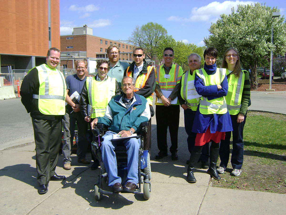
As explored in our How to Plan and Deliver a Better Engineering Project eBook, “Equitable engagement means fair and impartial, engaging equally with all concerned and impacted." Public engagement is a two-way process undertaken by community and/or project leaders to better understand stakeholder needs, values, and goals. The process includes engaging community stakeholders to obtain feedback and buy-in, inform and provide project transparency, generate excitement, and ultimately improve your projects.
We recognize that people who are affected by decisions have the right to be involved in the decision-making process. To ensure this happens the process must be inclusive and transparent. As a result, traditional community engagement practices often fall short. Equitable engagement recognizes the limits of traditional engagement practices and expands the toolbox with a variety of strategies to engage community stakeholders, especially those who have historically been or felt left out of the process.
For engagement to be equitable, it must seek participation that reflects a community’s entire geography and the identities of that community through an intentional and meaningful process. Race/ethnicity, age, and gender are other identities to consider for inequitable engagement. These include but are not limited to language diversity, cultural customs, income, religion, housing access, and status. It should also place specific emphasis on those who will be most impacted by the project, and those most often diminished in these conversations.
One effective tool to ensure equitable engagement is the Environmental Protection Agency’s (EPA) environmental justice (EJ) mapping and screening tool called the EJscreen. This tool is available to the public on the EPA’s website. The EJscreen is a web-based mapping tool used to access high-resolution environmental and demographic information for selected locations of your population. It is based on nationally consistent data and an approach that combines environmental and demographic indicators in maps and reports. This tool empowers users to identify areas with:
- Communities of color
- Cost-burdened communities
- Potential environmental quality issues
- Combination of environmental/demographic indicators
- Other relevant factors or ones that may be of interest
In general, the greater impact a project has on underrepresented populations, the higher level of engagement necessary to help ensure that it is implemented in a fair and equitable manner. The EJscreen can help you glean this information.
Due to the disproportionate impacts of pedestrian crashes and greater reliance on alternative transportation for traditionally underrepresented communities, safety data, demographic data, and gaps in facilities can be used collectively to identify focus areas of compounding issues within a project corridor and help to prioritize investments. SEH has applied this methodology to the Highway 47/Highway 65 Planning Environmental Linkages Study for MnDOT.
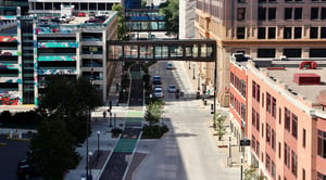
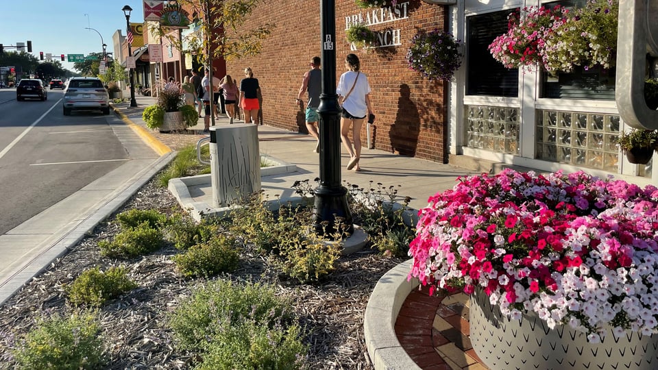
3. Eliminating the highway feel by going GREEN
Complete Streets principles define our streets as shared public spaces. Streets are more than a conduit for traffic; they often serve as outdoor rooms for our communities. After decades of focus on the movement of cars, however, many streets lack the aesthetic appeal and buffer from traffic necessary for attracting and serving the needs of a wider range of users. Streets also present us with the challenge of impermeable surfaces, stormwater run-off, and ponding that impacts all users and the health of the environment.
Solution: Add green infrastructure and streetscape elements
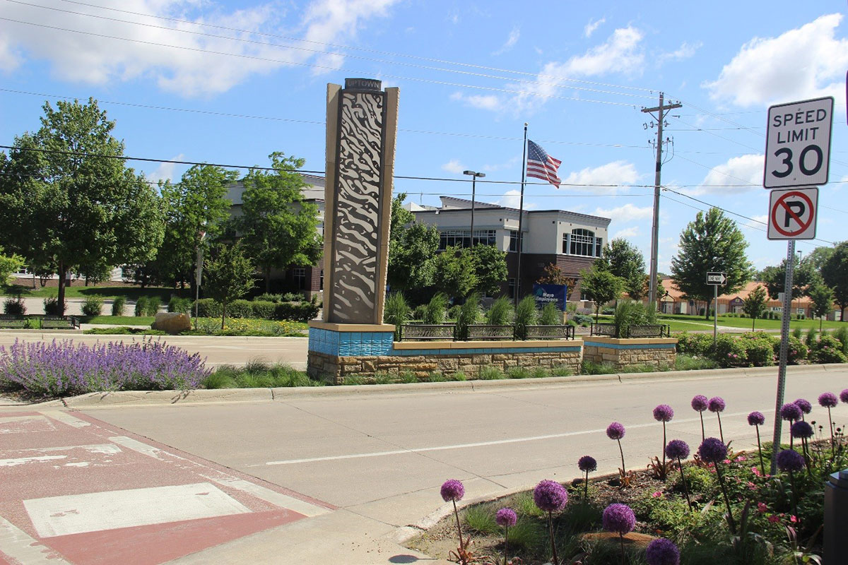
Transforming a street to eliminate the “highway feel” can be as simple as adding trees, streetscape furnishings, public art, and other plantings. These elements improve comfort for users, provide shade, and encourage social connection. But taking this a step further, Complete Streets projects provide an opportunity to integrate an overall stormwater treatment plan with innovative green infrastructure elements that help a project and community reach or exceed sustainability goals. This also ensures the street is safe from ponding and flooding for people using any mode of travel.
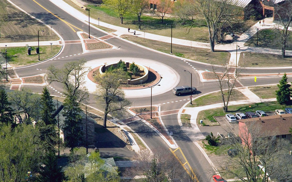
The 2nd Street SW Reconstruction project in Rochester, Minnesota, was constructed with several low-impact development stormwater practices – raingardens, a large bioswale median, structural soils, and native landscaping – that are not only mutually beneficial for ecology and traffic calming but also enhance the visual quality of the street.
4. Increasing walkability
Crossing the street should be efficient, safe, and easy. Yet, intersections with high turning volumes may have multiple turn lanes or channelized free-flowing lanes. From a pedestrian's standpoint, these lanes increase the crossing distance and exposure to automobile traffic.
Solution: Slow motorists down, empower your pedestrians
One way to increase walkability is to slow your motorists down – particularly those in channelized lanes – by using tighter radii or removing channelization completely. You can also improve walkability by increasing pedestrian visibility and shortening crossings with extended curbs, proper ramp placement, and median refuges. You can also improve visibility at unsignalized locations with pedestrian-activated devices such as Rectangular Rapid Flashing Beacons.
5. Providing for the safe flow of cars
Making room for all users sometimes means altering facilities and signalization previously designed to keep motorists moving. Signal timing, the number of lanes, and lane width are common concerns for Complete Streets efforts, mainly when traffic congestion is a concern.
Solution: Reach into the traffic toolbox
Great traffic engineers will know what tools you need for your Complete Streets efforts. They will conduct field reviews and technical analyses of multimodal safety and traffic operations to determine the street’s design and number of auto lanes. To address safety and operational issues, they may look for opportunities to add left-turn lanes at key locations or convert from four to three lanes.
Flexibility in signal phasing is also key to keeping a Complete Street flowing safely. This includes providing reasonable cycle lengths and phases that avoid excessive delays to cross streets, as well as phases to protect heavier turns where and when needed. Flashing yellow arrow traffic signals can help accomplish this. They allow left turns to be protected-only during heavy traffic periods (for example, automobiles being allowed to make a left turn only on green arrows), permissive-only during very light traffic periods (for example, left turns during a flashing yellow arrow must yield to oncoming traffic), or a combination of protected and permissive during other periods.
Signals can also include protected pedestrian and leading intervals, during which the permissive left or right turn operation is not allowed for all, or a portion of, the pedestrian crossing interval.
Often, there is room to reduce travel lane width. Space gained in these circumstances can be dedicated to other modes, green infrastructure, medians, or boulevards, which can assist in treating stormwater as well as calming traffic on corridors where speeding is common.
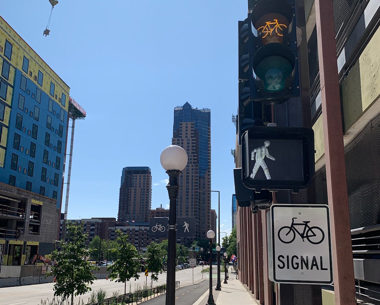
6. Improving comfort and safety for bicyclists
Our busiest streets are busy for a reason. They include key destinations and connections – sometimes across a barrier such as a highway or waterway. Making room for bicyclists on these corridors can be difficult because riding alongside high volumes of traffic is stressful for most riders. They need more space and protection to feel comfortable. Under higher volume and speed conditions, a 6 ft. bike lane may serve the most “strong and fearless” cyclists among us, but more separation is needed to encourage people of all ages and abilities.
Solution: Build a separated bikeway
Use planters, in-street curbs, delineators, barriers, and on-street parking to build separated bikeways (or cycle tracks) and provide bicyclists with physical separation from auto traffic. You can also place a separated bikeway at sidewalk level as long as you provide dedicated space for pedestrians. Facilities like these offer more comfort and security and, as a result, appeal to a wider spectrum of bicyclists.
At intersections with separated bikeways, consider protected intersection designs to reduce exposure for bicyclists and improve sightlines. Islands are used to reduce corner radii (and turning vehicle speeds) and provide separate queue spaces for bicyclists and pedestrians. They also set bicyclists back from the motor vehicle lane, making them more visible to turning motorists. Pedestrians also benefit from shorter crossing distances at protected intersections. Traffic signals with protected and leading bicycle phases can help reduce conflicts with heavier volumes of traffic.
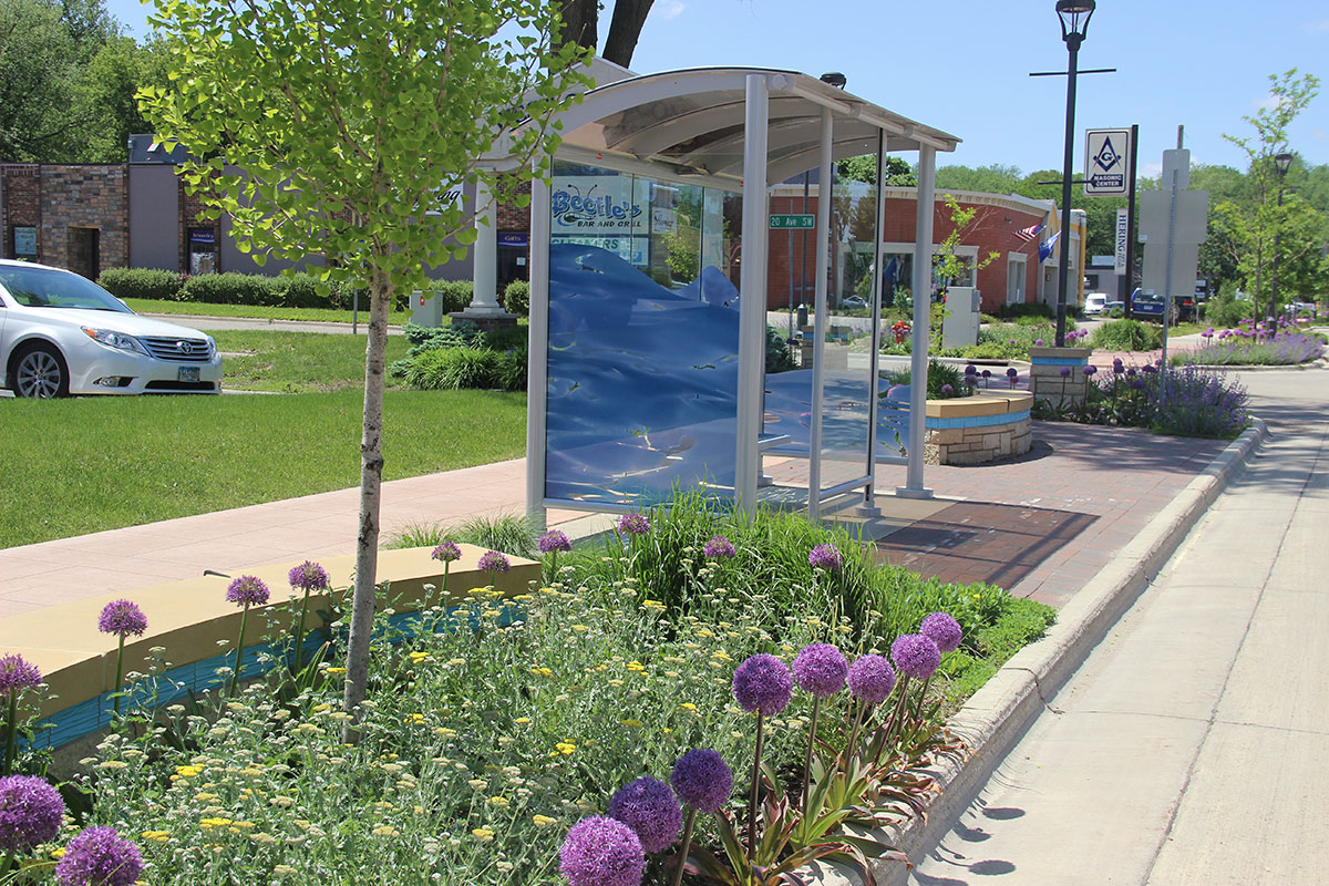
7. Integrating transit
Transit has many moving pieces. In addition to options for local, express, and rapid transit routes, there is also bus traffic, passengers, loading zones, shelters, benches, signage, and more to consider. Many of our streets are only complete with transit, but how do you integrate the entire system into your Complete Streets projects?
Solution: Keep both passengers and buses in mind
Remember, every transit trip begins and ends with a pedestrian trip – whether along a sidewalk, on a bicycle, or to a park and ride. It’s critical that transit stop designs are as efficient and safe for passengers as they are for the buses. This translates to well-designed stop areas, crosswalks, bikeway, and sidewalk connections that support ridership and minimize conflicts.
Also, keep in mind that stops on priority transit routes require more amenities – such as shelters, variable message signing, seating, bike parking, trash/recycling receptacles, and utility boxes – which means they need more space within the right-of-way. Plan ahead by coordinating with the local transit agency during the concept development process when considering space allocation for amenities and the provision of bays or in-lane passenger loading.
8. Balancing parking needs with those of other modes
The inclusion of on-street parking is often determined by the context of adjacent land use. That said, proposing any removal or reduction of on-street parking with a project is often perceived as a burden by business and property owners.
Solution: Understand use of the curb to best design parking that boosts local businesses and multimodal safety
Understanding delivery, transit, customer, and employee parking activities as well as bicycle parking and shared mobility along a street is crucial. At the beginning of a street project, consider conducting a curbside use inventory, parking study, and survey of business owners. On-street parking supports an urban character and development pattern, providing direct access to corridor businesses and also serves as a buffer from traffic for pedestrians along the sidewalk. It can also calm traffic in the adjacent auto lanes.
Parking bays can include curb extensions that reduce the crossing distance for pedestrians and increase pedestrian visibility by aligning them with the parking lane. In more constrained environments, consider flexible spaces along the curb that can serve different purposes depending upon time of day – daytime parking and loading, peak hour transit-only lanes, and late evening ride-share space.
In constrained environments where space is limited for the most vulnerable users of our streets – people walking, biking, and rolling – look to cross streets for parking options, shared parking for multiple businesses in adjacent lots, and consider district parking. District parking is a shared parking resource that is managed by a single entity such as a city or parking authority.
Bringing it all together
Every Complete Streets project is unique. The important factor is to remember that balancing the trade-offs is key to being inclusive of a more diverse range of users on your streets. This may translate to more effort in the near term, but the return on investment – economic development opportunities, safety for all, and inviting more sustainable communities, to name just a few of the substantive benefits – is far greater when streets serve people of all ages and abilities, using all modes of travel, and a broad range of needs.
Interested in learning more about Complete Streets policies and design concepts, or digging into your challenges and the best solutions? Let's connect!
About the Author

Heather Kienitz, PE*, is a senior multimodal traffic engineer, SEH principal, and Complete Streets advocate with 25 years of experience and a proven track record of delivering successful transportation projects. Heather is an active member of the Institute of Transportation Engineers (ITE), which developed the ITE Crosswalk Policy Guide, has participated in the delivery of MnDOT Complete Streets workshops, and assisted with the development of Minnesota’s Best Practices for Pedestrian and Bicycle Safety. These experiences have broadened her knowledge and given her unique perspectives on the challenges communities face in implementing Complete Streets. Heather is dedicated to creating inclusive, safe, and context-sensitive transportation solutions, particularly in the retrofitting and reconstructing pedestrian and bicycle infrastructure. Contact Heather
*Registered Professional Engineer in MN.